Running through the Arcadia mountains in the center of the Peloponnese
The Menalon Trail has been on my radar for a few years. Situated in Greece’s Arcadia region, it traverses 75km of mountains from Stemnitsa to Lagadia, passing some of the most dramatic scenery steeped in history. Making use of old mule paths, the trail joins nine historic villages in the Gortinyan Mountains.
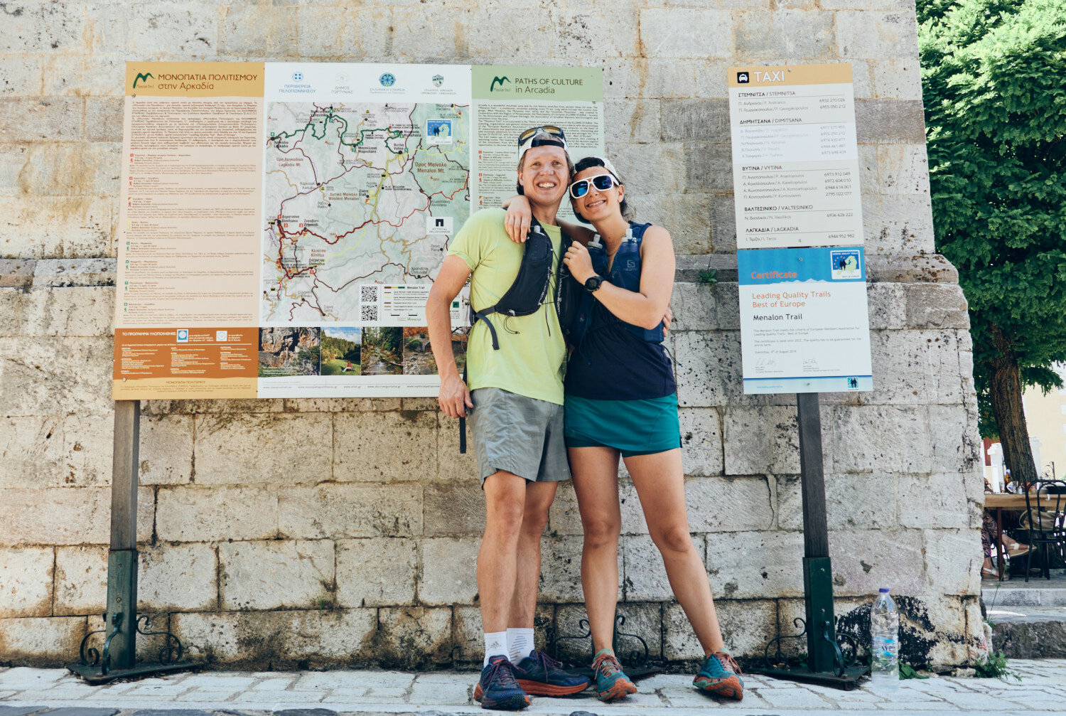
Unlike other remote hiking routes, this one has a hook—it’s clearly marked with signposts along its entirety. Navigating trails without clear markings can be tiring, frustrating, and even dangerous. This trail does everything it needs to attract hikers from all over the world. And it’s been noticed. The Menalon Trail is the first trail in Greece that is certified by the European Ramblers Association.
The Menalon Trail in 3 stages – 86km | 3850m+
The Menalon Trail day 1: Elliniko to Dimitsana
DISTANCE: 20km ELEVATION: 1250m
While the Menalon trail is classed as an eight-stage trail, I calculated that a runner could cover the distance in a little over two days. We drove from Athens to Dimitsana, parked at our first night’s hotel, and took a taxi down the valley to Elliniko. While the official start of the trail is Stemnitsa, the additional 500m climb from Eliniko makes for a more runner-friendly day.
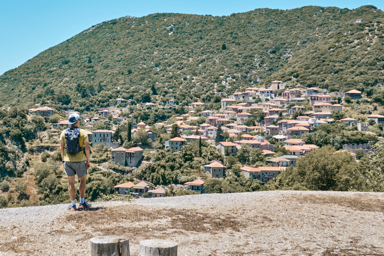
The trail between Stemnitsa and Dimitsana is a 12.5km stretch of the Menalon Trail that is known for its jaw breaking views and scenery. Leaving the village of Stemnitsa, the trail follows the Louisos Gorge down to the village of Dimitsana. Along the way, you will pass by ancient monasteries, wildflower meadows, and stunning views of the surrounding valleys and Lykaion mountain.
The trail is relatively easy and can be completed in a few hours, making it an short day on the feet. There’s plenty to keep you occupied once arriving in Dimitsana.
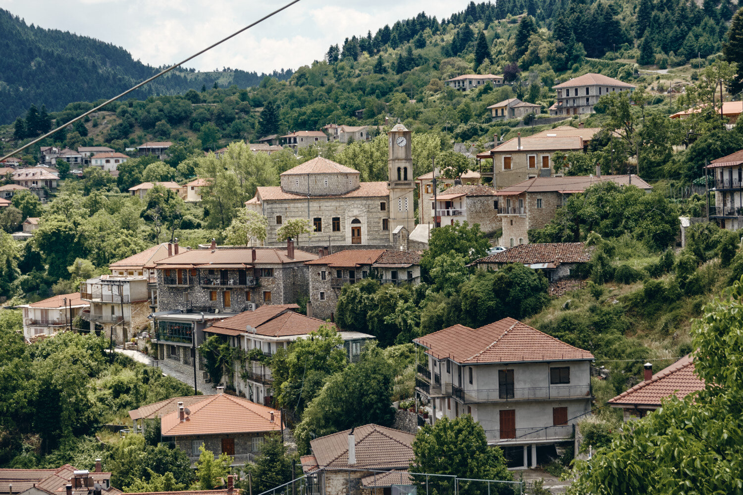
Dimitsana is a picturesque village surrounded by mountains and rivers, with stunning views of the surrounding countryside. Dimitsana is known for its historical sites and traditional Greek architecture, including its neoclassical mansions, while its many churches and monasteries provide reminders of the area’s long and rich history. The village is also known for its hospitality and friendly locals, making it the perfect place for the first night on the Menalon Trail.
Five minutes into the trail and we already passed the first church. The trail is dotted with small white churches all along the route, each offering a moment of respite to admire the surrounding beauty. Every step of the trail is a reminder of the history and culture of the area, while also providing stunning views of the surrounding mountains and valleys.
Even though Elliniko to Stemnitsa is not on the main trail, the route is well signposted for its 5km, 500m+ climb. The trail winds its way up the mountain, passing through forests of beech and chestnut trees. Despite the steep incline, the trail is worth it for the breathtaking views of the surrounding countryside that you get at the top.
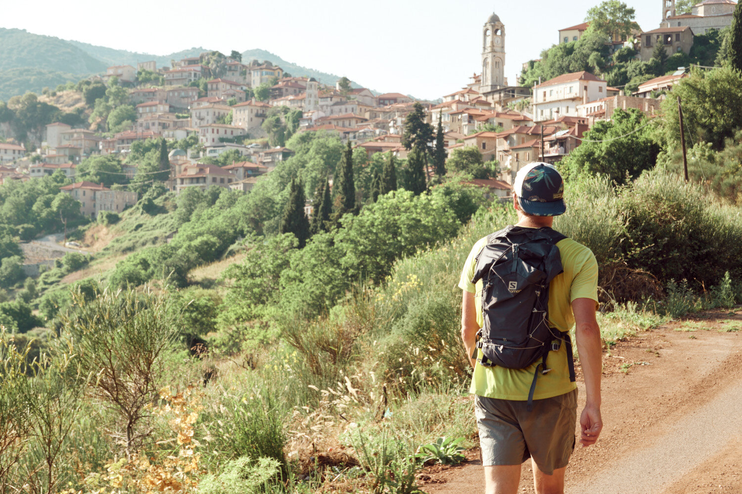
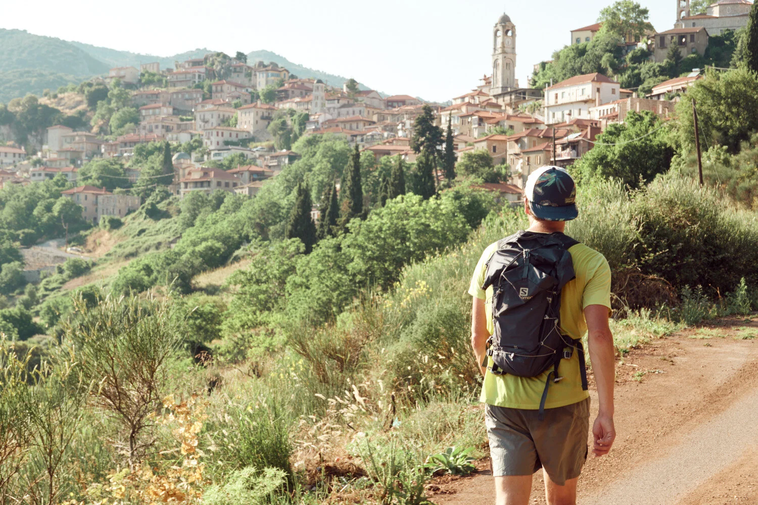
At the entry of Stemnitsa, the start of the Menalon Trail, I’m filled with excitement and anticipation. I know that the next 12.5km stretch is going to be an amazing journey through the stunning Greek countryside, taking in the ancient monasteries in through the Louisos gorge.
Stemnitsa is the true start of the Menalon Trail. Starting further down the valley in Eliniko makes for a more runner-friendly distance, and it meant we could stop in Stemnitsa for lunch.

All of the afternoon objectives unfold from this viewpoint of the Louisos Gorge. We can see the monasteries dotted throughout, and our destination of Dimitsana, towards the top of the frame. With a renewed sense of energy, we set off on the trail, ready to tackle the final few hours of our journey.

Prodromos Monastery clings to the cliff face at the bottom of the Louisos Gorge, providing an awe-inspiring sight as you make your way down the trail. The monastery was built in the 12th century and is still in use today; it is a reminder of the long and rich history of the region. The views from the monastery are truly breathtaking, with the surrounding mountains providing a stunning backdrop.

Monastery, one of the oldest in Greece, takes a more prominent location on the right. As we make our way down the trail, the monasteries offer us a moment of respite to admire the stunning landscape, and remind us of the rich history and culture of the area.
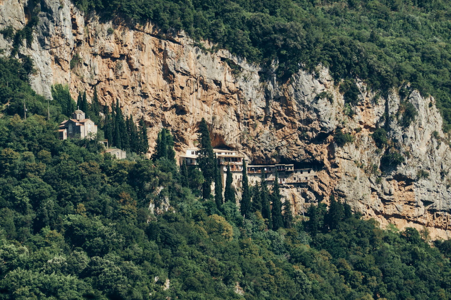
Prodromos Monastery nests under the rock in the spectacular Louisos Gorge. Dating back to the 12th century, this monastery is a reminder of the long and rich history of the area, and a testament to the faith of its people. The monastery is precariously placed, clinging to the cliff face, and provides stunning views of the surrounding countryside. It’s easy to see why this is a highlight of the Menalon Trail.
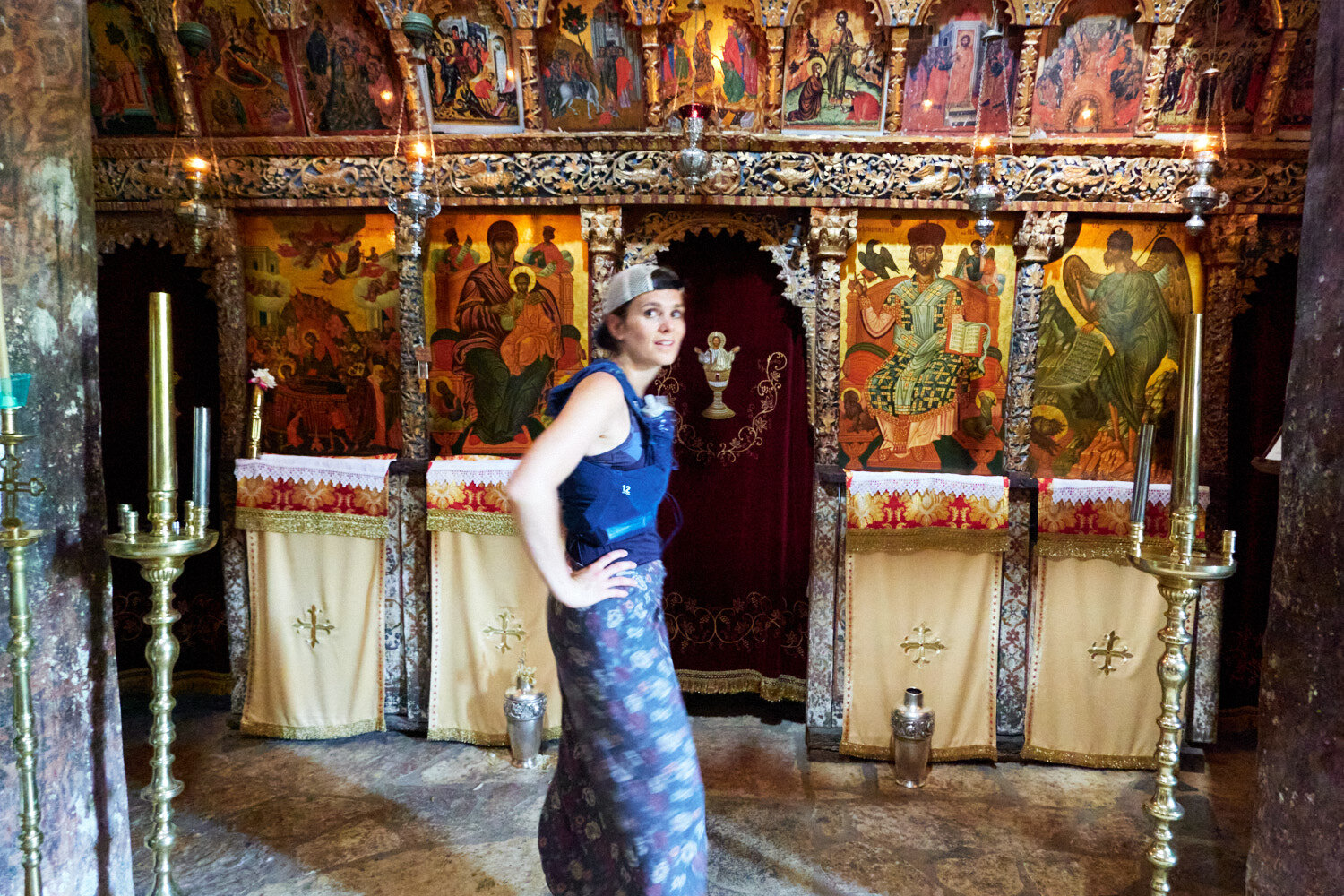
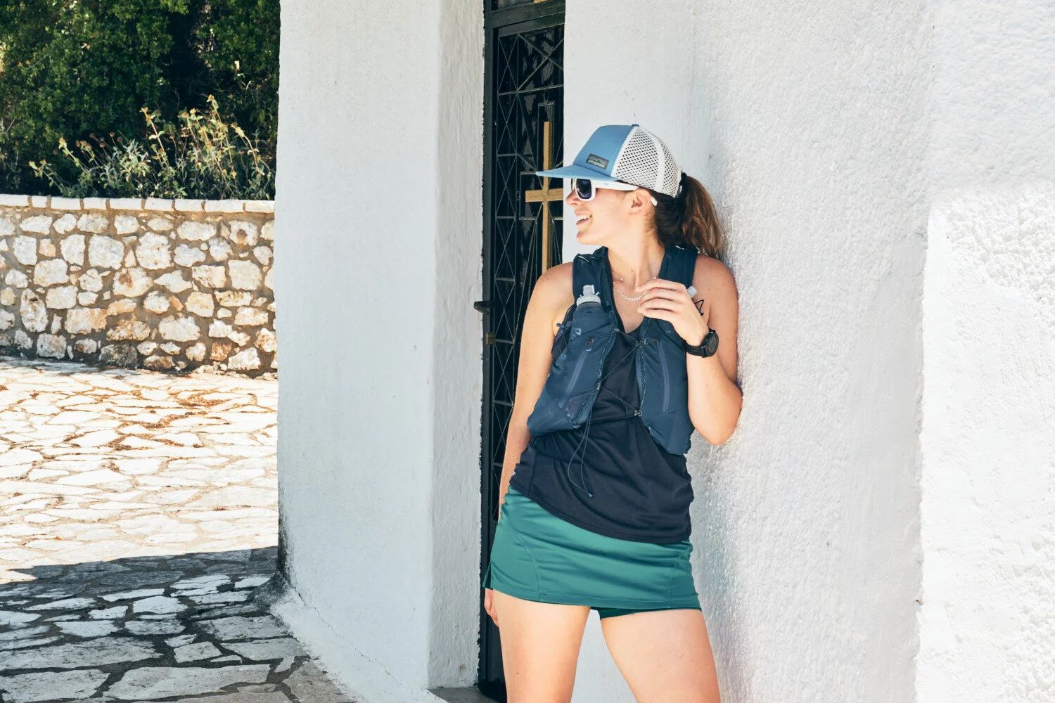
Flat cap on backwards, running vest, sarong. Well dressed for a visit to admire the Philosophou Monastery.

The Menalon Trail is colour-coded over the three days. Red, yellow, and green trail markers show you the way.

En Dimitsana Guesthouse is a cozy guesthouse located at the end of the first day of the Menalon Trail. It has stunning views of the surrounding mountains and valleys. The guesthouse offers comfortable accommodation and delicious local cuisine, as well as a friendly atmosphere and warm hospitality. After an afternoon running, it’s the perfect place to relax and enjoy a sunset beer.
The Menalon Trail day 2: Dimitsana to Vytina
DISTANCE: 27km ELEVATION: 1000m
After leaving Dimitsana, we climbed up into the mountains. The treeline reached the summits, and paths often opened up to plateaus, which threw us off a sense of progress on the way to Zygovisti.
We planned to eat at the small village of Elati, which is a 1km climb off the main trail, though we arrived at a deserted village. The local taverna was locked and nobody around—all except two dogs who were more than happy to help us eat our only Cliff Bar.
The lack of people was again a talking point as we passed through a second day without crossing other people. When we arrived in the cute mountain town of Vytina later in the day, it was clear we were the first tourists on the trail in 2020.
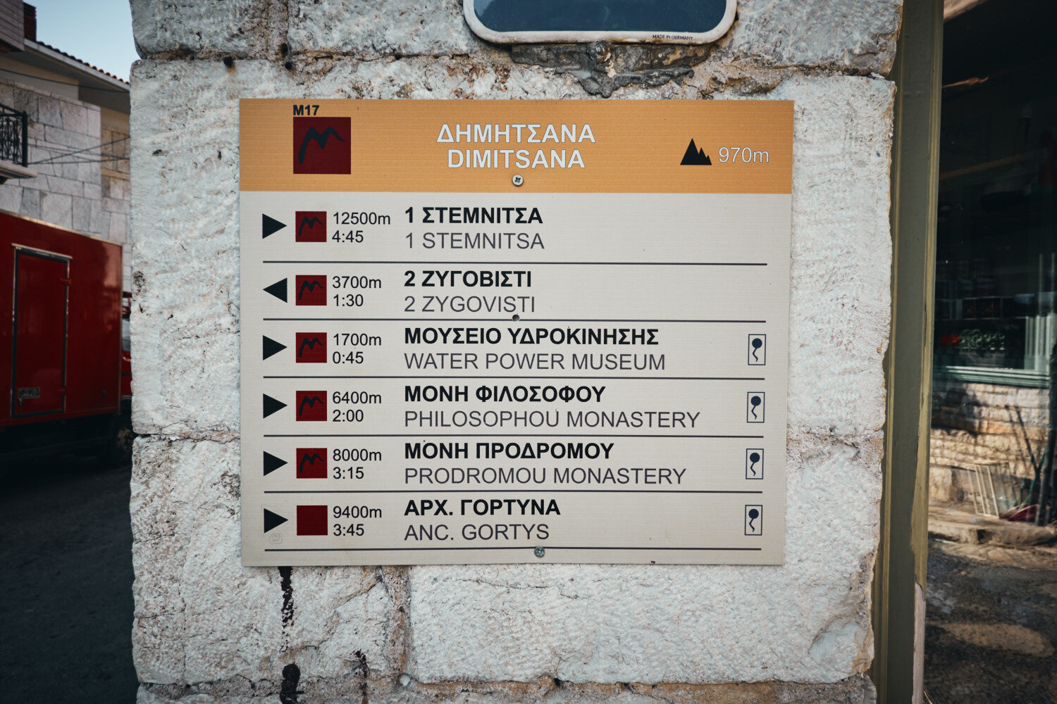
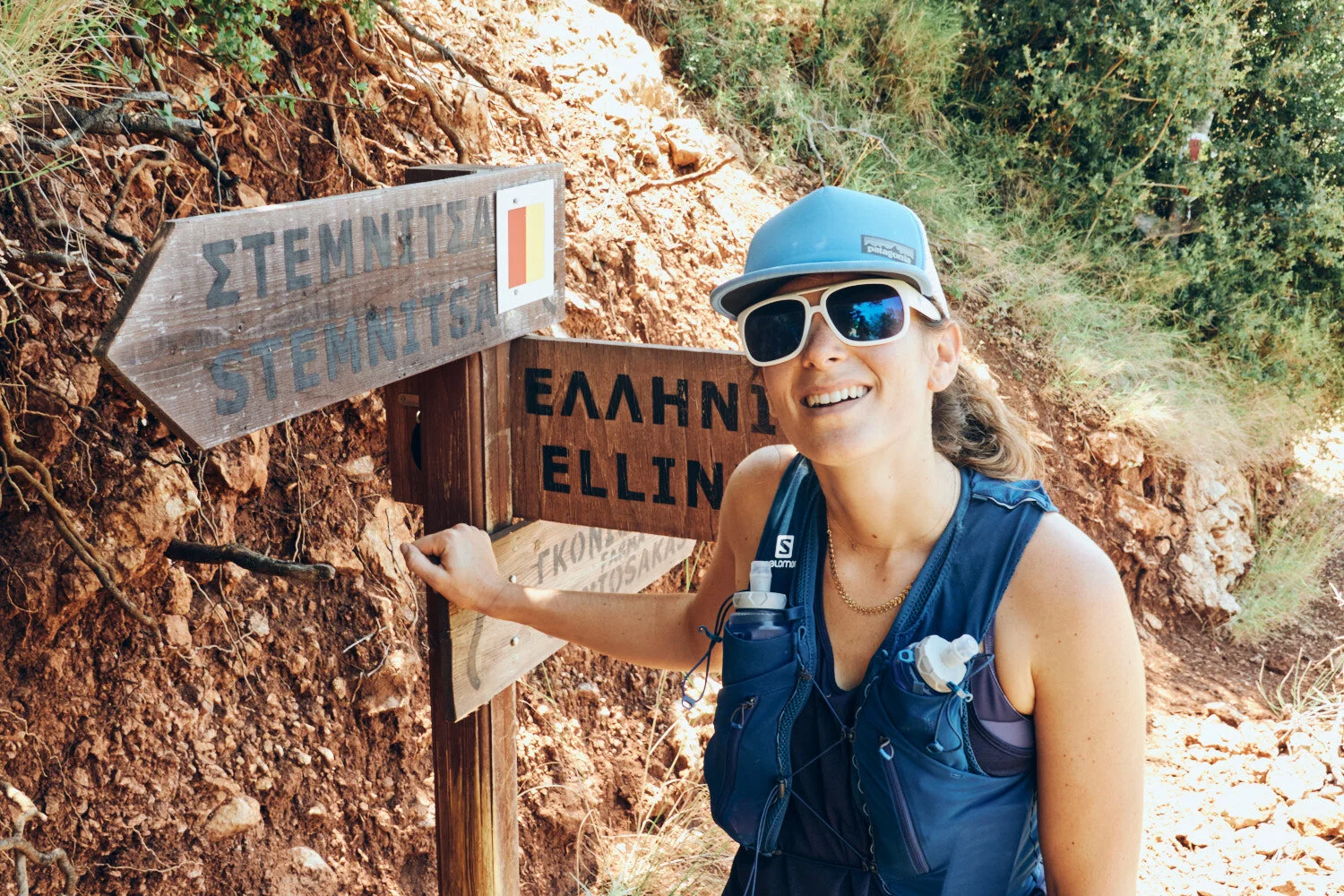
Navigating your route is made easy with destinations in both Greek and English, distance markers, and estimated travel times.

All packed for two days on the trail. We had left our car at the first night stop in Dimitsana and would return by taxi after finishing the following day.

The sun rises over the hills of Dimitsana as a shepherd drives a flock of animals through the early morning air.

A short climb leads to a breathtaking view of the picturesque town of Dimitsana, the jewel of the Arcadia region.

Giant books on the path on day two.

11.5km to our lunch stop in Elati. We had no idea at this point that we would arrive to a shuttered village.

We had to keep an eye out for turtles sunning themselves in the warm sunshine.
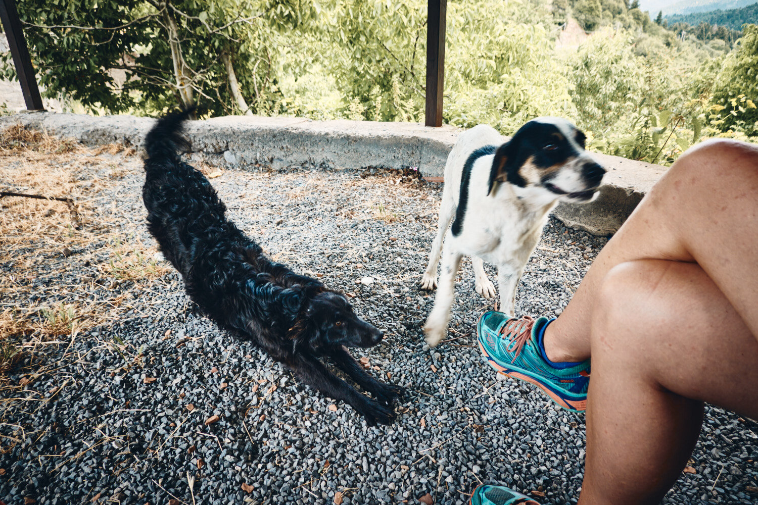
Lunch stop in Elati. Nothing open and two dogs more than happy to share our sole Cliff Bar and sachet of Trail Butter.

Climbing up from the depths of the Mylaon Canyon and onto the lush hills of Vytina, where you can take in the stunning views of the surrounding landscape.

We ran the trail at the end of June. Daily temperatures were around 27c, and we found water easily along the route.

The section between Elati and Vytina is considered one of the most beautiful parts of the Menalon Trail, and with it being deserted, it was the perfect spot for a secluded skinny dip.
The Menalon Trail day 3: Vytina to Lagkadia
DISTANCE: 38.5km ELEVATION: 1600m
We knew that the day had the potential to turn into a slog, so we started as soon as the bakery opened at 7 am. Spinach pies and coffee onboard, we had mentally split the day in two.
Today our stops were full of delights—ice creams, lemonade, greek salad, souvlaki, and even a beer. Quite the feast compared to the previous day’s Cliff Bar.
Arriving at the finish line in Lagkadia, we had covered the 86km (3800m+) route in two and a half days. We approached the trail with a fastpacking mentality—carrying the essentials for three days while mostly power hiking. Our definition of “runnable terrain” evolved over the three days, stepping up to a jog only when the slope seemed ideal!

As the sun rises on day three, we set off from Vytina, ready to tackle the day ahead.

Almost 40km ahead of us meant a strategic breakfast order at the bakery in Vytina.

Leaving Vytnia with pastries and coffee to accompany the first kms.

Early morning in the impressive ravine outside of Vytina.

As we hiked through the lush countryside, we were greeted by the buzzing of bees hard at work in their hives. A reminder of the beauty and harmony of nature.
Valtesiniko proved to be a great place for lunch, with several restaurants and cafes offering a variety of tasty dishes. After the previous day’s less-than-stellar experience, we were happy to find a satisfying meal to fuel us for the rest of the day’s run.

After hours of running, the sight of a small ice cream shop in the quaint village of Magouliana was a welcome relief.

After red and yellow, it was the turn of the green signposts to guide your way.

The drag from Valtesiniko to the finish line in Lagkadia tested our endurance. As the heat beat down on us, we dug deep and pushed on to the end.

Job done! Elliniko to Lagkadia (86km) in two and a half days. The Menalon Trail is everything we hoped for and more. A runnable trail in a beautiful region of Greece.
Menalon Trail Logistics
START: GETTING TO ELLINIKO
The closest airport is Athens (ATH).
By road, Dimitsana is around 2 and a half hours drive from Athens.
Most walkers tackle the trail by basing themselves at one location and taking a taxi to the trailhead each day. We decided to park the car at the end of the first day in Dimitsana. From there we took a €25 taxi to the start of the trail in Elliniko.
FINISH: LEAVING LAGADIA
Having left the car in Dimitsana, we arranged for a €25 taxi to take us back.
ADDITIONAL RESOURCES:
Menalon Trail Maps
 My first ever night wild camping. I’d taken along Outside Magazine to read and hurriedly flipped past the article about double murder on the Appalachian Trail. The Aiguille de Midi and Mont Blanc offer a nice view for the first night. The headlamps of runner competing in the TDS race can be seen in the mountains far right.
 A better view of the TDS race. I completed this race myself in 2013 and it’s truly an incredible course. With a 20km downhill followed by a 2000m ascent, this race gives it all. This image captured around 1am would be the runners coming in around 50th place.
 Italy! Oh man, what a view. The second race of the weekend was the CCC. Again, I’ve competed in this race in 2012 and it kicked my ass. That year the course was shortened due to heavy snow. No such problems this year as I made my camp high above Courmayeur in time for sunset. A refuge was about 20 minutes walk away, so once pitched I grabbed a couple of beers for the night.
 Just like sunset, sunrise was pretty epic too. The CCC started at 9am, giving me the chance to pack up slowly and hike a little into the course before the lead runners were due by.
 Tour de Mont Blanc route markings on the Italian side. The UTMB is only for one weekend and the majority of people walk the 170km route. Having spent quite a bit of time over the last years on the route, I can’t recommend it highly enough. Its amazing.
 Walking up to the CCC course, I could see a helicopter dropping off organisers at the high point of the race.
 10:04am. Despite the CCC race having started at 9am, the runners had a big climb before they got to me. Plenty of time to grab some running self portraits.
 10:45am and the lead pack come by flying. Nike Trail Running had brought along some athletes who dominated the event from start to finish. I like the track athletics feel to their kits, with short shorts and vests as opposed some of the tight fitting gear that’s loved in Europe.
 10:46am and i’ve rotated my body 45 degrees since the last shot. The course that follows the UTMB races, especially around the Italian Val Ferret, is simply incredible.
 The weather always plays a major role in the outcome of the UTMB races. As I just mentioned, we had heavy snow in 2012 and it was really tough going. This year it was the heat, with a period of high temperatures ready to greet the racers. Lots of unscheduled stops into pools of water and streams was the order of the races.
 Racing towards the first aid station at the Italian Refuge Bertone, these runners still had to cross over into Switzerland and then into France before their race would be done.
 Following the days earlier CCC, I had to head back to Geneva to pick up my girlfriend to join me on night 3. Our date night involved driving to Arnouva, at the end of the Val Ferret, grabbing dinner and hiking up towards the Grand Col Ferret with headlamps on. The peak marks the boundary between Italy and Switzerland and it’s one of my favourite places in the world. It’s also well placed at around 100km into the UTMB.
 We pitched the tent on the side of the route and grabbed some sleep before the front runners came past at 5.45am. The first ten competitors were quite spread out and Julien Chorier (pictured here) made his way past us as the sun just started to rise. I’ve worked with Julien a lot now and I often use him for my French practice. Upon asking him how he was doing, he told me that he couldn’t put his full foot down anymore or do any running. Not quite understanding what he replied (his response was translated to me afterwards), I gave the standard “Super, allez, allez, bravo” encouragement that most French runners afforded. Poor guy. He was just trying to tell me how he was feeling. He abandoned the race at the next checkpoint.
 Shortly after Julien passed, the light started to creep up and over the peaks to start warming the valley.
 Our camp becomes apparent as the starts to brighten the valley, with the shadows of mountains showing how great this place is. Not a bad spot and right on the UTMB course too.
 Joe Grant makes his way up the slopes of the Grand col Ferret, just as the light starts to touch the ridges of the mountain.
 Shortly afterwards, an explosion of light wakens up the valley. Fernanda Maciel came past just after 8am, whereas the last runner wouldn’t pass through this area for another twelve hours.


 1,2,3,4,5,6,7,8…………….I count 30.Outdoor photographers love clean images. We can often be seen crawling around on the ground making sure that our field of view is uncluttered with nothing else, especially other photographers, encroaching on our frame. Every now and again though it feels nice to break the mould, bringing me to today’s behind the shot, focusing on a series of images from this years Mont Blanc Marathon.I’ve never been a huge fan of finish line images. Like podium presentations they often feel like a necessary evil with a nod in the direction of the sponsors rather than the athletes themselves. More often than not these images see a quick turnaround with them forgotten about the following day. I’ve been on a mission of late to take scenes from an editorial setting, such as a race like this, and make a completed image that stands the test of time,
  Despite feeling like herded cattle, i firmly believe that many accredited journalists (much like the iPhone “journalist” above) just don’t question the possibility of photographing from somewhere else. Maybe it’s the power of the media pass around their neck dictates that they have the right to photograph from a hallowed position that keeps them from straying, despite the fact that their lens is aimed at exactly the same point as 50 or so other people.I’ll admit, moving position though was a gamble. I had two of Elisa Desco’s sponsors requiring images and she had held together her side of the bargain by being in a position to win the race. The marathon distance that this year would crown the winner as World Champion was kind of a big deal. Elisa had fought off intense competition and entered the finishing straight after 3hr53. With every other photographer preoccupied with the finish line, I was able to capture some great moments from this unique angle. I mentioned it was a gamble and it really was. There’s a huge risk that a photo from behind could prove unflattering, uninspiring and just plain busy.As you can see from the image in the header, this made its way to become advertising for Scott Shoes (with Compressport also using one of the shots in the series). There’s no fear of an unflattering image here, her figure looks incredible and the fact that all of the photographers are fully clothed in waterproofs really adds to the environment.
 Of course, media accreditation is a great tool that we have at our disposal during events, but it’s great to take a step back and think about how to create different images to all the others, that will stand that test of time that i talked about. A week after this race I photographed a series on the Tour de France without accreditation and it proved to be a great lesson in working hard for my shots. The Tour de France is a logistical nightmare at the best of times and without a pass, there has to be some intense planning on what you want to achieve from that day. A selection of shots from that project are now available on a