Welcome to WordPress. This is your first post. Edit or delete it, then start writing!
Category: Uncategorised
-
Embracing the Trails: A glimpse back at UTMB in Chamonix
I love the UTMB. At the core of its allure lies the loop around Mont Blanc, one that breaks down the concept of a race and turns it more into a hell of a journey. Crossing through France, Italy, Switzerland, and back into France, you run through the day and night (most people 2 nights) past hundreds of spectators who have navigated to the middle of nowhere to cheer strangers on through the night. It’s an experience that’s equal part bizarre and beautiful.
Having photographed UTMB week on numerous occasions and ran in the races too, I find myself reflecting as the 2023 edition approaches. I’ve taken a nostalgic look back at some of the images captured over the years.
Kilian Jornet’s victory in 2011 opened my eyes to the world of trail running, and right then, I made a vow to return to Chamonix to participate in these races. Staying true to my commitment, I completed the CCC in 2012, followed by the TDS in 2013. In 2014, I took on the UTMB, though I unfortunately did not finish. Another attempt at the TDS in 2016 ended in another DNF, leaving me with what one might call ‘unfinished business’.
It was raining at the start of 2014 when I set off, completely underprepared for the adventure that lay ahead. Earlier that summer, while photographing the Mont Blanc Marathon, I had fallen and bruised a rib, limiting my training to a mere 30km as my longest run. Needless to say, the odds were stacked against me from the beginning.
The start in Chamonix is a blend of excitement and nerves, as everyone begins to grasp the journey that lies ahead. The UTMB offers its rewards, but they come hand in hand with challenges. One thing is for sure: Every runner is soon to regret how fast they tackle the first 8km to Les Houches on the swift and winding single track.”
Although 2017 wasn’t Kilian’s year for victory, his presence left a lasting impression on all who followed his journey.
I waited patiently in an area where I wasn’t supposed to be until the leaders arrived at the Courmayeur aid station at 2:30 in the morning. Somehow, all the other media had been redirected elsewhere, leaving me alone to do my thing.
The Grand Col Ferret truly bites. Even during warmer years, the temperature drops as you ascend towards the Swiss border from the Val Ferret. I experienced its challenge in 2012 during the CCC, just before the UTMB route was rerouted due to snow up there. In 2014, I crossed it again during the UTMB (though that race is a bit of a blur), and in 2015, I even camped up there. Then, in 2017, I hiked up in the middle of the night to catch the morning runners.
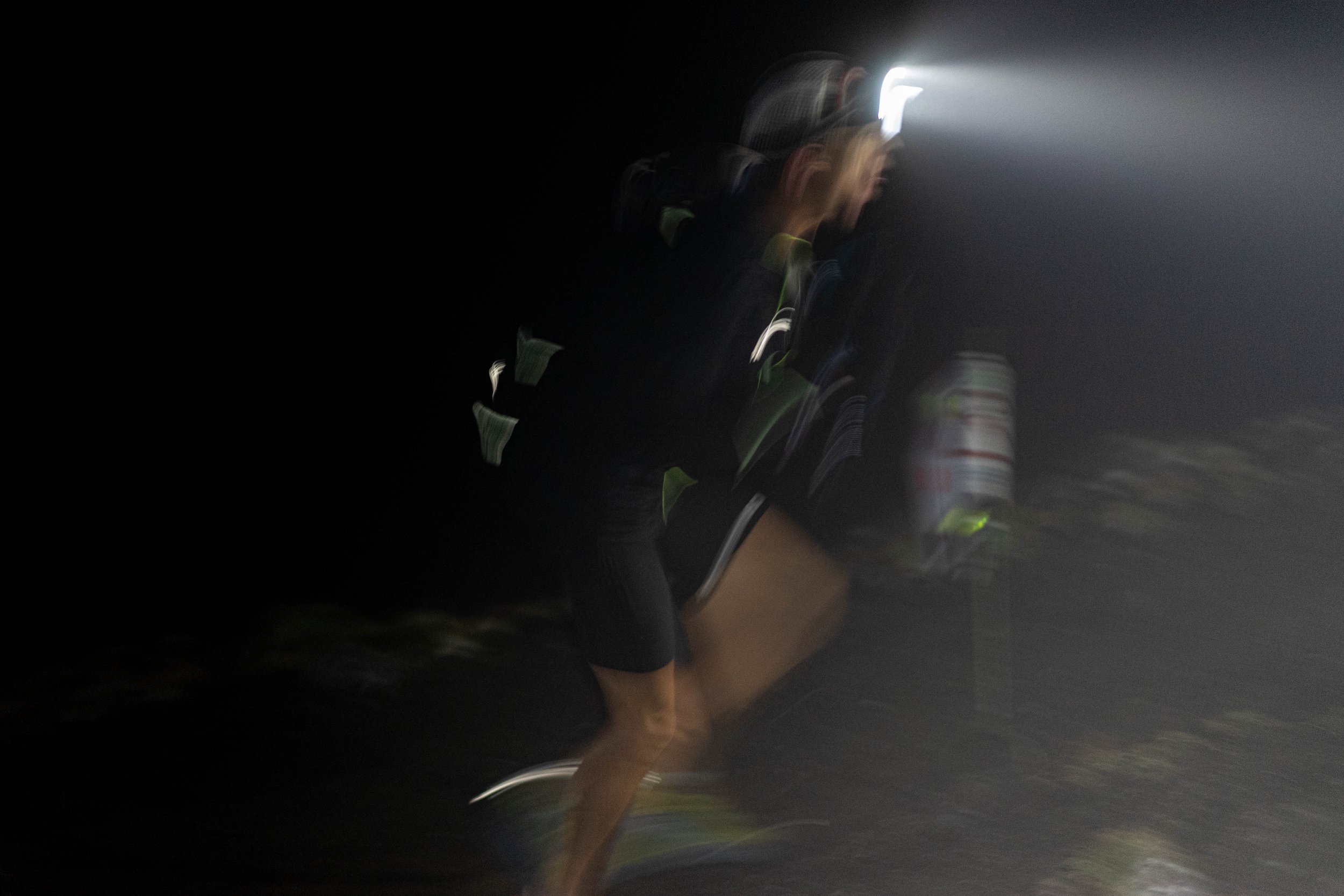
At 6:17 am, I was on the run into Courmayeur in 2014. Little did I know, I would endure another 12 hours out on the trails – not covering much ground – before deciding to call it a day in La Fouly. Since then, I haven’t had the opportunity to run the race again.
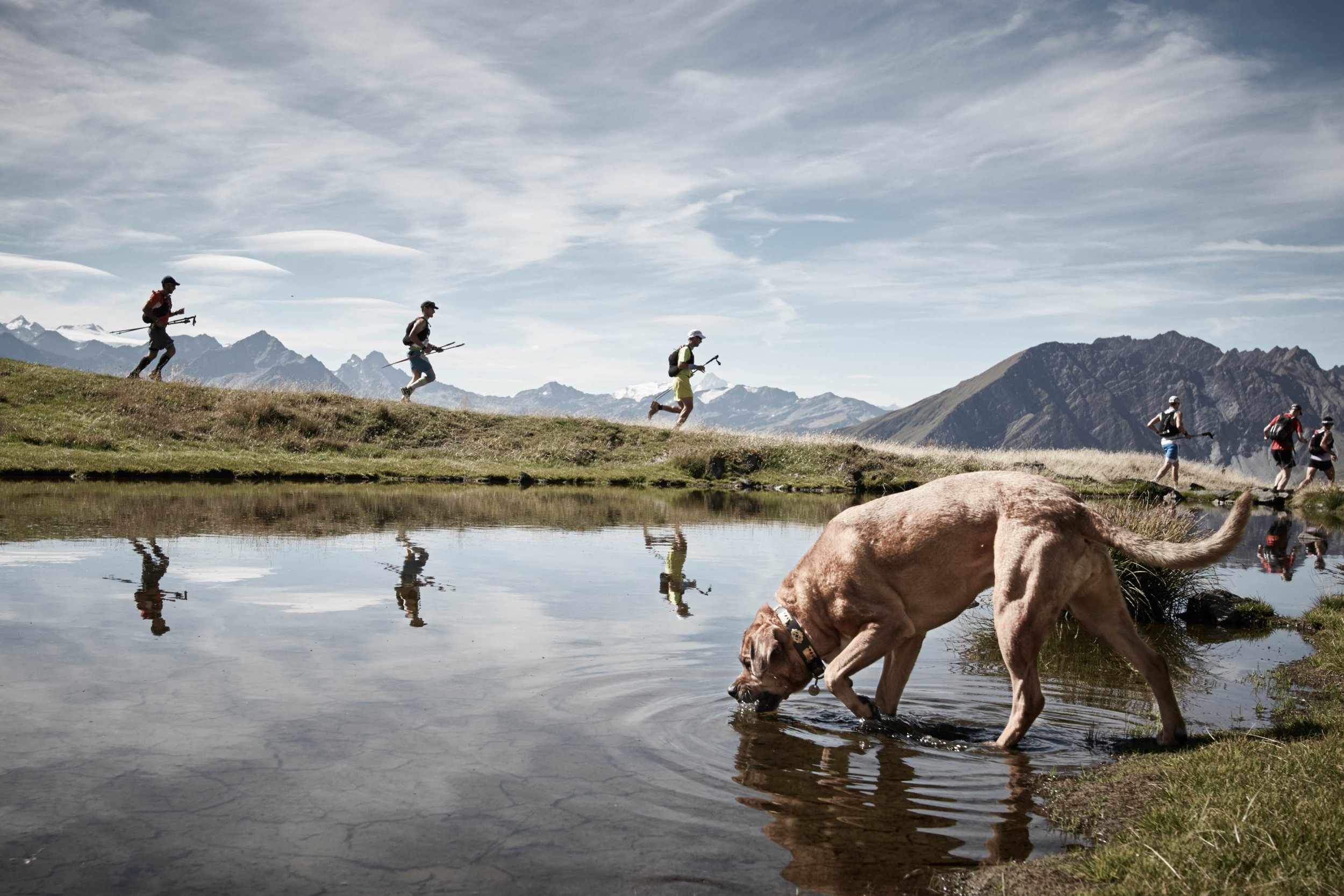
My old dog (RIP) watches on the CCC runners at the star of their race in 2015.
Live-streaming on my wedding day in 2022 🙂 Two runners under sub-20 hours. Wow.
-
A Road Trip Through Morocco with a One-Year-Old: Exploring the Atlas Mountains, Gorges, Desert, and Marrakesh
Agdz is one of the most picturesque locations on the trip. It coincided with peak “wild child” for our daughter.
A One-Year-Old’s First Adventure in Morocco: Exploring its Beauty by Road Trip.
Morocco blew me away. It’s a land of vibrant colors, rich culture, and stunning landscapes. Over the new year, we decided to take a road trip with our one-year-old daughter to experience a family adventure in this North African country. We flew into Marrakesh and rented a car, taking a circular route that took us through Ourika, Skoura, Dades and Todra Gorges, Zagora, the desert, and back up the Draa Valley. Along the way, we soaked in the diverse landscapes and the warm hospitality of the Moroccan people who loved seeing a toddler having the time of her life.
The foothills of the Atlas Mountains in Ourika
From Ourika to Skoura over Tizi n’Tichka Pass
An afternoon in the Todra Palmeraie
Give me a dune, and I will roll until I can roll no more. Erg Chigaga with its endless entertainment.
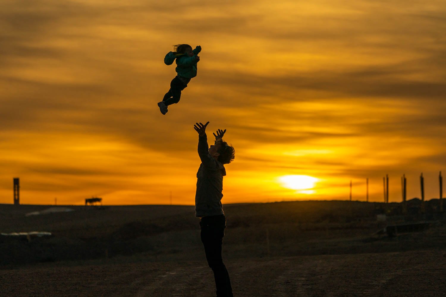
Great light, good airtime. Wrapping up the trip in Agafay.
A Leica – Sony combination
I kept my photography gear simple during the road trip, relying on two cameras and lenses. The combination of the Leica Q2 and Sony A7II allowed me to capture the sights of Morocco in a versatile way. I love having the Leica around my neck. The 28mm lens is lovely. With its advanced sensor and lens technology, its outstanding image quality delivers sharp, vivid images.
On the other hand, I still enjoy the versatility of my Sony A7II, despite having owned it since a 2015 trip to the Himalayas. Despite its age, when paired with the 70-200 f4 lens, the Sony A7II produces an image that I can be more than happy with for personal use. The 200mm focal length provided by Sony allowed me to zoom in on distant subjects, capturing both intimate and impactful images. I have considered adding Sony’s 200-600 lens to my collection. While large white lenses can be cumbersome to travel with, I appreciate the additional reach they offer and the ability to capture subjects from a distance, contrasting the up-close and personal feel of the Leica Q2.
I’ve had the Sony A7II since 2015. It’s fine to chew on.
Starting in the foothills of the Atlas Mountains in Ourika
We started the journey at the beautiful Kasbah Bab Ourika. This family-friendly accommodation provided the perfect base to explore the surrounding mountains and traditional Berber culture. We had initially considered venturing into the higher mountains, but we thought it might be too unstable with snow. As it turned out, Morocco was experiencing a dry period, so we could have headed further into the Atlas mountains.
Driving from Ourika to Skoura over Tizi n’Tichka Pass
Driving out of Ourika and over the Tizi n’Tichka pass of the Atlas mountains was a fun experience in our two-wheel drive Dacia. The road snakes through the mountains, with hairpin turns and steep inclines, providing panoramic views of the surrounding peaks. On the other side of the pass is Ourrzazate. Home to a couple of film studios, we stopped only for lunch before continuing on the road across to Skoura.
Skoura is a lush oasis known for its beautiful palm grove and traditional kasbahs. The palm grove has rows upon rows of palm trees stretching out as far as the eye can see with winding dust tracks that make no directional sense to navigate to the night’s accommodation.
The golden hour shines bright in Skoura.
A morning hike in the Dades Gorge
Although we only spent the morning in the area, the Dades Gorge was one of the most memorable days of the road trip. The gorge, located in the Dades Valley, stretches from the Atlas Mountains to the Sahara Desert, and it provides a stunning landscape, including rock formations carved over time by the Dades River. The Dades Gorge is a narrow, winding road that runs through the valley, offering breathtaking views of the red rock formations that tower above. We parked the car and hiked a short way up the valley. Travelling with a child is a lesson in compromise, as we saw the path climbing up and up into the far distance. Another time and we would have been running up the path for a full day on our feet.
A cheeky monkey in Monkey Fingers, Dades Gorge.
An afternoon in the Todra Palmeraie
After a lunchtime stop alongside the road for tagine, we drove an hour or so to the Todra Gorge, another spectacular canyon in the eastern part of the High Atlas Mountains. The Todra Gorge is known for its towering red cliffs that soar up to 300 meters above the Todra River.
We spent the afternoon in the palmeraie, a beautiful oasis of palm trees in the arid landscape of the gorge. The palmeraie, with its abandoned Kasbah, offered an idyllic backdrop for walking practice. Teodora had started experimenting with her first steps the day before, and now it was all about adventure, trial, and error. Fall back down. Get back up.
The beauty of the abandoned kasbah comes alive in the warm glow of the evening light.
Hiking the Todra Loop
The following morning, we set out to hike the Todra Loop, a stunning trail that takes you through the heart of the Todra Gorge. The hike starts by following a narrow path that winds along the Todra River. As the gorge opens up, the trail climbs steeply into a cliff band, offering incredible panoramic views of the surrounding peaks and the winding river below.
The Todra Loop is an excellent hike for nature lovers and those looking for an adventure, with a good sense of accomplishment as you reach the village below. We’ve got the sharing of backpack duties dialled. Mamma climbs up, and Pappa downhill.
Warming rays filter through the narrow walls of the Todra Gorge.
The road less travelled from Todra Gorge To Zagora
The drive from Todra Gorge to Zagora is a journey through some of Morocco’s most diverse landscapes. After leaving the cliffs of Todra behind, we made our way through the arid terrain of the Anti-Atlas mountains, passing by small villages and traditional kasbahs. Hours of driving through vast areas of nothing make for a fun and adventurous drive.
The stunning Draa valley greets you as you arrive in Zagora. It’s usually an oasis of palm trees and lush vegetation stretching over 100km. However, it had been over two years since it had rained in the region, which has been challenging. We set down for the evening with the daily ritual of mint tea to the soundtrack of an unnecessarily loud musician duo.
Patagonia-styled on the streets of Zagora.
New Years eve in Erg Chigaga
One of the trip’s highlights was the 4WD excursion into the Erg Chigaga Desert. Amidst the rolling dunes, we spent a memorable New Year’s Eve in the (luxury) wilderness. The vast night sky is one of the main draws, so it was unlucky to have the only cloudy night of our entire trip. Sleeping in a tent in the middle of the desert kept us busy as we continually jumped up to check the temperature of our sleeping baby.
The following day, we were up early to witness the magnificent sunrise over the desert, an unforgettable experience. Our drive back to Zagora was just as remarkable, surrounded by the barren desert landscape of the Draa Valley. A night in the desert was undoubtedly one of the trip’s most memorable and perfect ways to start the new year.
The vast and tranquil landscape of the Erg Chigaga desert at dusk.
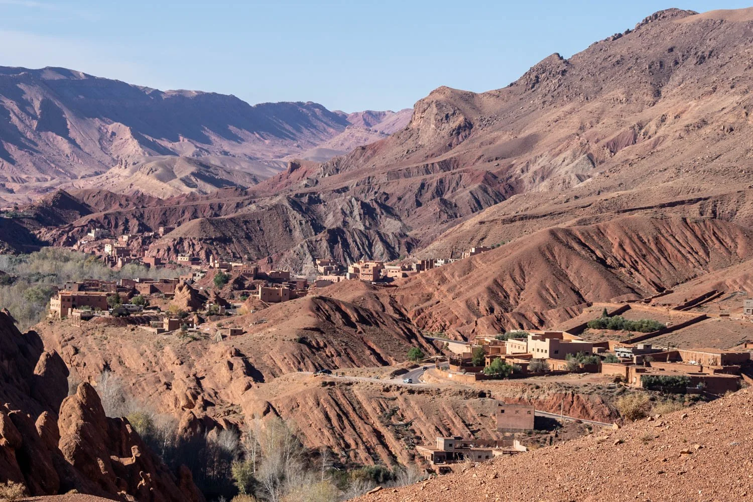
The Draa Valley up to Agdz
Agdz was one of my favorite locations in Morocco, with such a stunning landscape, even in the face of drought. The lack of rain meant the absence of an oasis that should have been directly in front of our accommodation, but the region was still otherworldly. I crossed the mountain ranges in my mind, looking up to imagine the adventure. For us, Agdz marked the peak of our wild child. Several days of crawling around the floor in the dust and desert were starting to show!
An evening game of “you won’t pass” illuminated by sunset in Agdz.
The mountains stand tall, illuminated by the warm light of the setting sun in Agdz.
Agdz to Agafay: making the loop
After leaving Agdz, we continued our journey north towards Agafay, a small desert village on the outskirts of Marrakesh. Along the way, we stopped at the UNESCO World Heritage site of Ait Ben Haddou, a fortified town famous for its well-preserved kasbahs and traditional architecture spruced up by the Hollywood dollar. After days of wandering around deserted Kasbahs, it felt pretty bizarre to be surrounded by coach-loads of tourists, but the location and the architecture still make it a must-see. We likened it to a Moroccan Yvoire for those familiar with the French town on the shores of Lac Leman.
All aboard the Deuter backpack to explore the stunning UNESCO site of Ait Ben Haddou.
Full circle back to Marrakesh
As we came to the end of our road trip around Morocco, we returned to Marrakesh for our final night. Despite not having the same admiration for the city as we did for the other places we visited, we still found it an interesting and exciting place to wrap up our trip. The city’s bustling souks, vibrant culture, and stunning architecture provided an exciting contrast to the more remote and tranquil locations we had visited earlier on the trip.
Too much fun to rest on the streets of the medina.
-
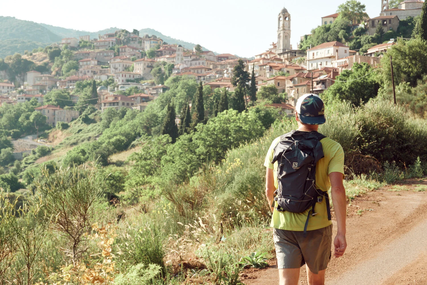
The Menalon Trail: An Epic Three-Day Running Journey Through Greece
Running through the Arcadia mountains in the center of the Peloponnese
The Menalon Trail has been on my radar for a few years. Situated in Greece’s Arcadia region, it traverses 75km of mountains from Stemnitsa to Lagadia, passing some of the most dramatic scenery steeped in history. Making use of old mule paths, the trail joins nine historic villages in the Gortinyan Mountains.
Unlike other remote hiking routes, this one has a hook—it’s clearly marked with signposts along its entirety. Navigating trails without clear markings can be tiring, frustrating, and even dangerous. This trail does everything it needs to attract hikers from all over the world. And it’s been noticed. The Menalon Trail is the first trail in Greece that is certified by the European Ramblers Association.
The Menalon Trail in 3 stages – 86km | 3850m+
The Menalon Trail day 1: Elliniko to Dimitsana
DISTANCE: 20km ELEVATION: 1250m
While the Menalon trail is classed as an eight-stage trail, I calculated that a runner could cover the distance in a little over two days. We drove from Athens to Dimitsana, parked at our first night’s hotel, and took a taxi down the valley to Elliniko. While the official start of the trail is Stemnitsa, the additional 500m climb from Eliniko makes for a more runner-friendly day.
The trail between Stemnitsa and Dimitsana is a 12.5km stretch of the Menalon Trail that is known for its jaw breaking views and scenery. Leaving the village of Stemnitsa, the trail follows the Louisos Gorge down to the village of Dimitsana. Along the way, you will pass by ancient monasteries, wildflower meadows, and stunning views of the surrounding valleys and Lykaion mountain.
The trail is relatively easy and can be completed in a few hours, making it an short day on the feet. There’s plenty to keep you occupied once arriving in Dimitsana.
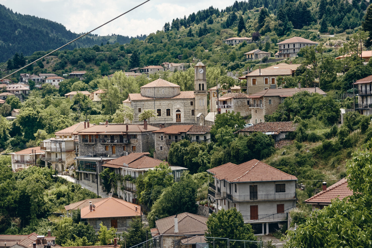
Dimitsana is a picturesque village surrounded by mountains and rivers, with stunning views of the surrounding countryside. Dimitsana is known for its historical sites and traditional Greek architecture, including its neoclassical mansions, while its many churches and monasteries provide reminders of the area’s long and rich history. The village is also known for its hospitality and friendly locals, making it the perfect place for the first night on the Menalon Trail.
Five minutes into the trail and we already passed the first church. The trail is dotted with small white churches all along the route, each offering a moment of respite to admire the surrounding beauty. Every step of the trail is a reminder of the history and culture of the area, while also providing stunning views of the surrounding mountains and valleys.
Even though Elliniko to Stemnitsa is not on the main trail, the route is well signposted for its 5km, 500m+ climb. The trail winds its way up the mountain, passing through forests of beech and chestnut trees. Despite the steep incline, the trail is worth it for the breathtaking views of the surrounding countryside that you get at the top.
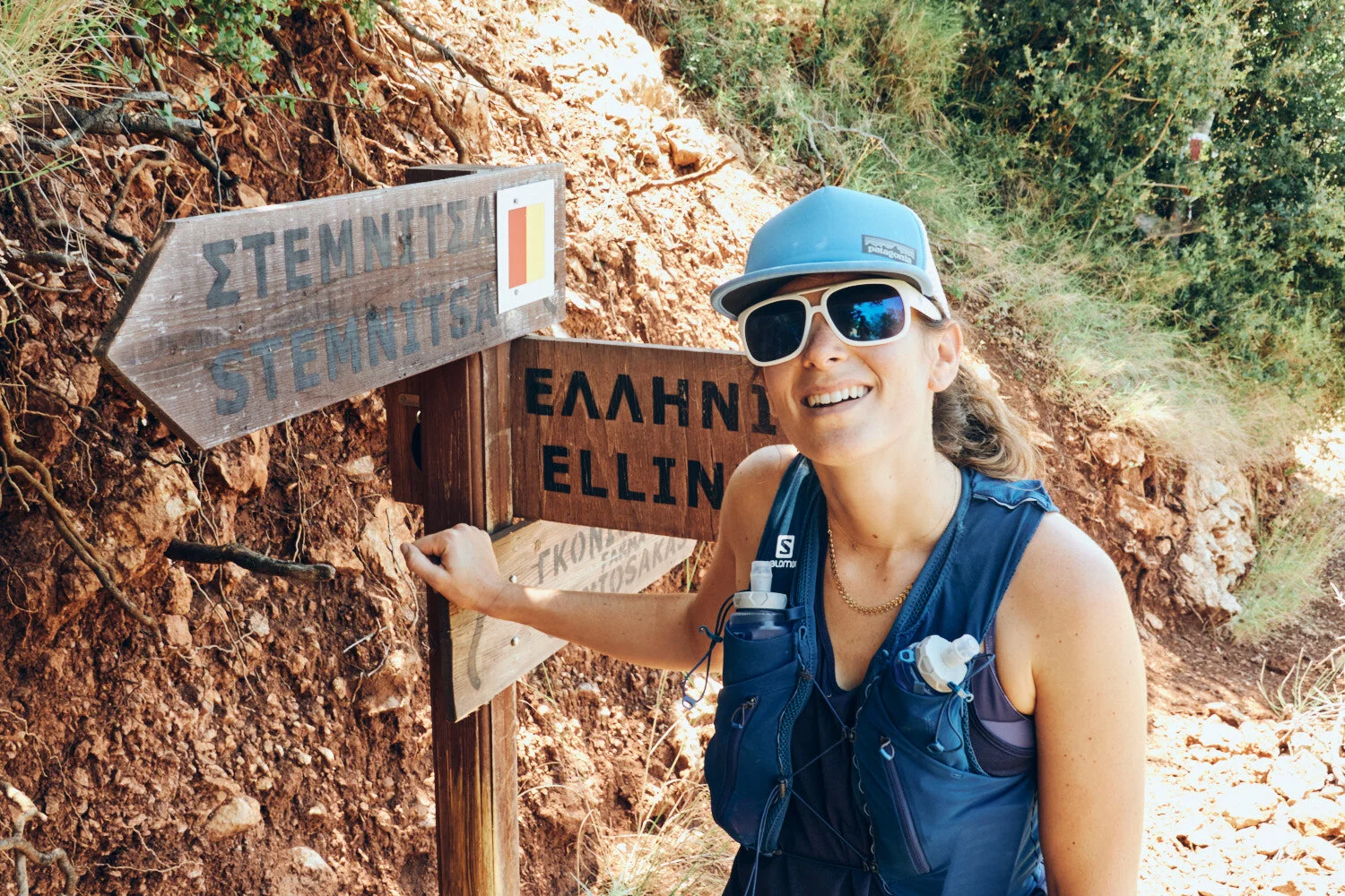
At the entry of Stemnitsa, the start of the Menalon Trail, I’m filled with excitement and anticipation. I know that the next 12.5km stretch is going to be an amazing journey through the stunning Greek countryside, taking in the ancient monasteries in through the Louisos gorge.
Stemnitsa is the true start of the Menalon Trail. Starting further down the valley in Eliniko makes for a more runner-friendly distance, and it meant we could stop in Stemnitsa for lunch.
All of the afternoon objectives unfold from this viewpoint of the Louisos Gorge. We can see the monasteries dotted throughout, and our destination of Dimitsana, towards the top of the frame. With a renewed sense of energy, we set off on the trail, ready to tackle the final few hours of our journey.
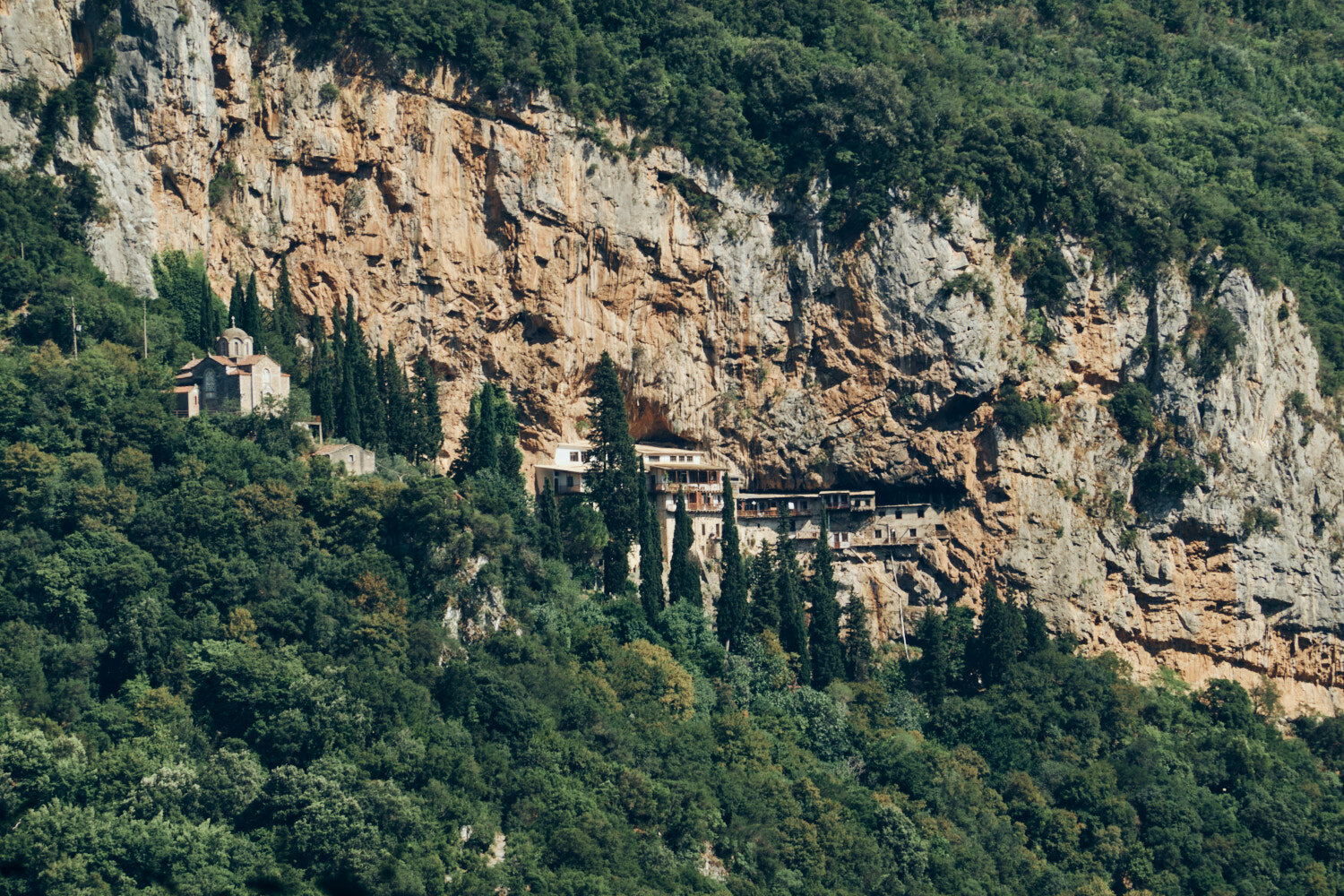
Prodromos Monastery clings to the cliff face at the bottom of the Louisos Gorge, providing an awe-inspiring sight as you make your way down the trail. The monastery was built in the 12th century and is still in use today; it is a reminder of the long and rich history of the region. The views from the monastery are truly breathtaking, with the surrounding mountains providing a stunning backdrop.
Monastery, one of the oldest in Greece, takes a more prominent location on the right. As we make our way down the trail, the monasteries offer us a moment of respite to admire the stunning landscape, and remind us of the rich history and culture of the area.
Prodromos Monastery nests under the rock in the spectacular Louisos Gorge. Dating back to the 12th century, this monastery is a reminder of the long and rich history of the area, and a testament to the faith of its people. The monastery is precariously placed, clinging to the cliff face, and provides stunning views of the surrounding countryside. It’s easy to see why this is a highlight of the Menalon Trail.
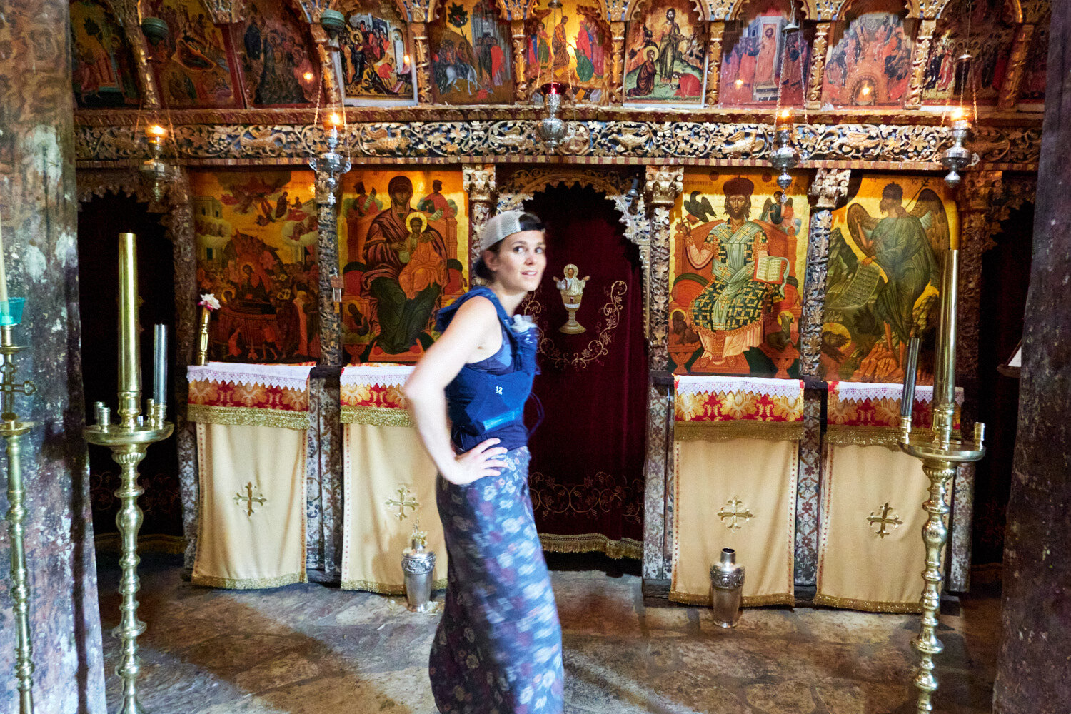
Flat cap on backwards, running vest, sarong. Well dressed for a visit to admire the Philosophou Monastery.
The Menalon Trail is colour-coded over the three days. Red, yellow, and green trail markers show you the way.
En Dimitsana Guesthouse is a cozy guesthouse located at the end of the first day of the Menalon Trail. It has stunning views of the surrounding mountains and valleys. The guesthouse offers comfortable accommodation and delicious local cuisine, as well as a friendly atmosphere and warm hospitality. After an afternoon running, it’s the perfect place to relax and enjoy a sunset beer.
The Menalon Trail day 2: Dimitsana to Vytina
DISTANCE: 27km ELEVATION: 1000m
After leaving Dimitsana, we climbed up into the mountains. The treeline reached the summits, and paths often opened up to plateaus, which threw us off a sense of progress on the way to Zygovisti.
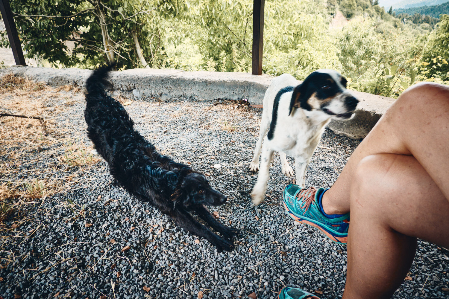
We planned to eat at the small village of Elati, which is a 1km climb off the main trail, though we arrived at a deserted village. The local taverna was locked and nobody around—all except two dogs who were more than happy to help us eat our only Cliff Bar.
The lack of people was again a talking point as we passed through a second day without crossing other people. When we arrived in the cute mountain town of Vytina later in the day, it was clear we were the first tourists on the trail in 2020.
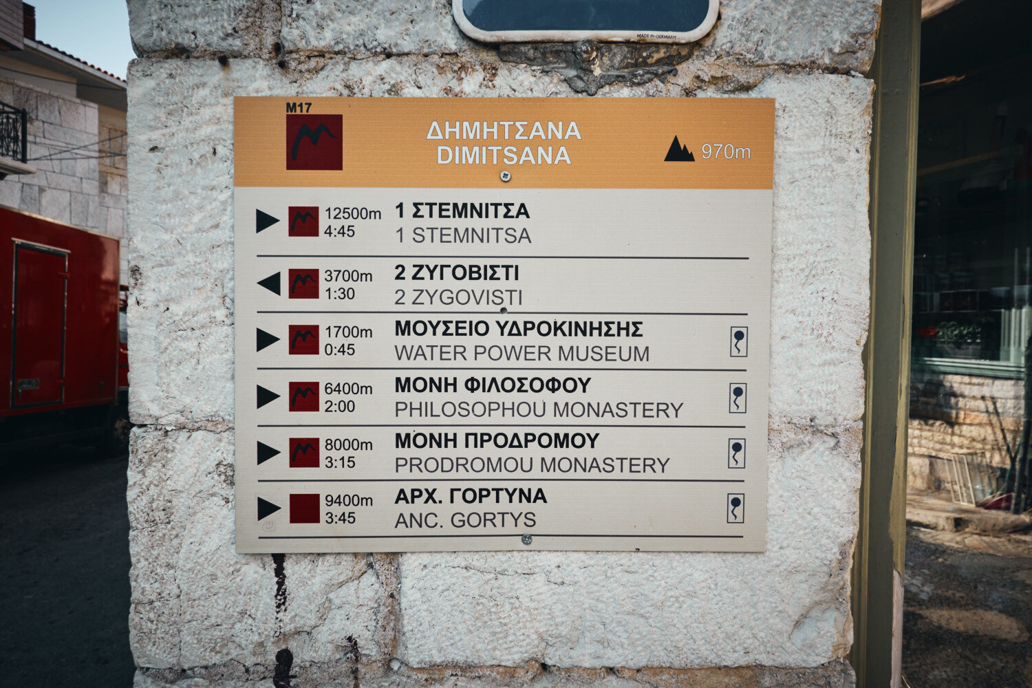
Navigating your route is made easy with destinations in both Greek and English, distance markers, and estimated travel times.
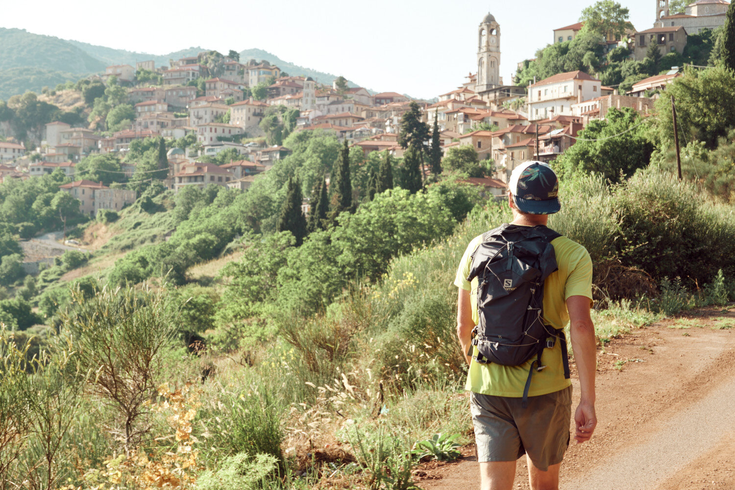
All packed for two days on the trail. We had left our car at the first night stop in Dimitsana and would return by taxi after finishing the following day.
The sun rises over the hills of Dimitsana as a shepherd drives a flock of animals through the early morning air.
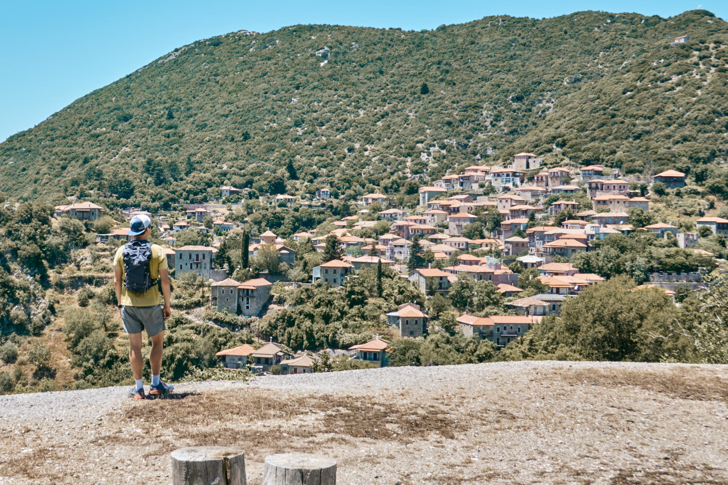
A short climb leads to a breathtaking view of the picturesque town of Dimitsana, the jewel of the Arcadia region.
Giant books on the path on day two.
11.5km to our lunch stop in Elati. We had no idea at this point that we would arrive to a shuttered village.
We had to keep an eye out for turtles sunning themselves in the warm sunshine.
Lunch stop in Elati. Nothing open and two dogs more than happy to share our sole Cliff Bar and sachet of Trail Butter.
Climbing up from the depths of the Mylaon Canyon and onto the lush hills of Vytina, where you can take in the stunning views of the surrounding landscape.
We ran the trail at the end of June. Daily temperatures were around 27c, and we found water easily along the route.
The section between Elati and Vytina is considered one of the most beautiful parts of the Menalon Trail, and with it being deserted, it was the perfect spot for a secluded skinny dip.
The Menalon Trail day 3: Vytina to Lagkadia
DISTANCE: 38.5km ELEVATION: 1600m
We knew that the day had the potential to turn into a slog, so we started as soon as the bakery opened at 7 am. Spinach pies and coffee onboard, we had mentally split the day in two.
Today our stops were full of delights—ice creams, lemonade, greek salad, souvlaki, and even a beer. Quite the feast compared to the previous day’s Cliff Bar.
Arriving at the finish line in Lagkadia, we had covered the 86km (3800m+) route in two and a half days. We approached the trail with a fastpacking mentality—carrying the essentials for three days while mostly power hiking. Our definition of “runnable terrain” evolved over the three days, stepping up to a jog only when the slope seemed ideal!
As the sun rises on day three, we set off from Vytina, ready to tackle the day ahead.
Almost 40km ahead of us meant a strategic breakfast order at the bakery in Vytina.
Leaving Vytnia with pastries and coffee to accompany the first kms.
Early morning in the impressive ravine outside of Vytina.
As we hiked through the lush countryside, we were greeted by the buzzing of bees hard at work in their hives. A reminder of the beauty and harmony of nature.
Valtesiniko proved to be a great place for lunch, with several restaurants and cafes offering a variety of tasty dishes. After the previous day’s less-than-stellar experience, we were happy to find a satisfying meal to fuel us for the rest of the day’s run.
After hours of running, the sight of a small ice cream shop in the quaint village of Magouliana was a welcome relief.
After red and yellow, it was the turn of the green signposts to guide your way.
The drag from Valtesiniko to the finish line in Lagkadia tested our endurance. As the heat beat down on us, we dug deep and pushed on to the end.
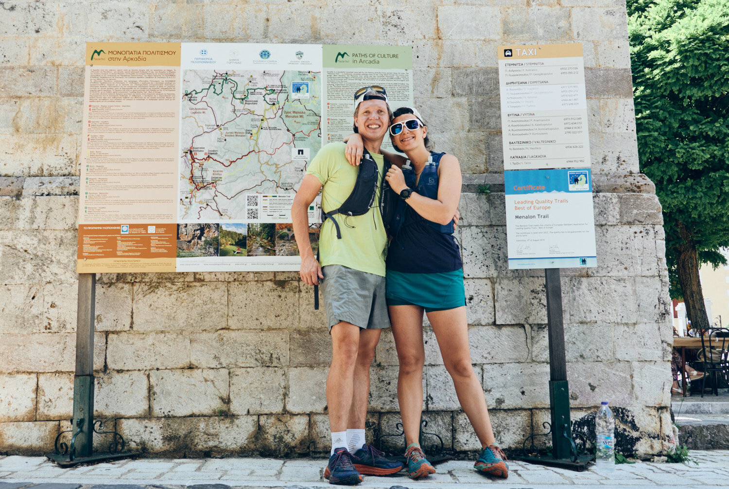
Job done! Elliniko to Lagkadia (86km) in two and a half days. The Menalon Trail is everything we hoped for and more. A runnable trail in a beautiful region of Greece.
Menalon Trail Logistics
START: GETTING TO ELLINIKO
The closest airport is Athens (ATH).
By road, Dimitsana is around 2 and a half hours drive from Athens.
Most walkers tackle the trail by basing themselves at one location and taking a taxi to the trailhead each day. We decided to park the car at the end of the first day in Dimitsana. From there we took a €25 taxi to the start of the trail in Elliniko.
FINISH: LEAVING LAGADIA
Having left the car in Dimitsana, we arranged for a €25 taxi to take us back.
ADDITIONAL RESOURCES:
Menalon Trail Maps